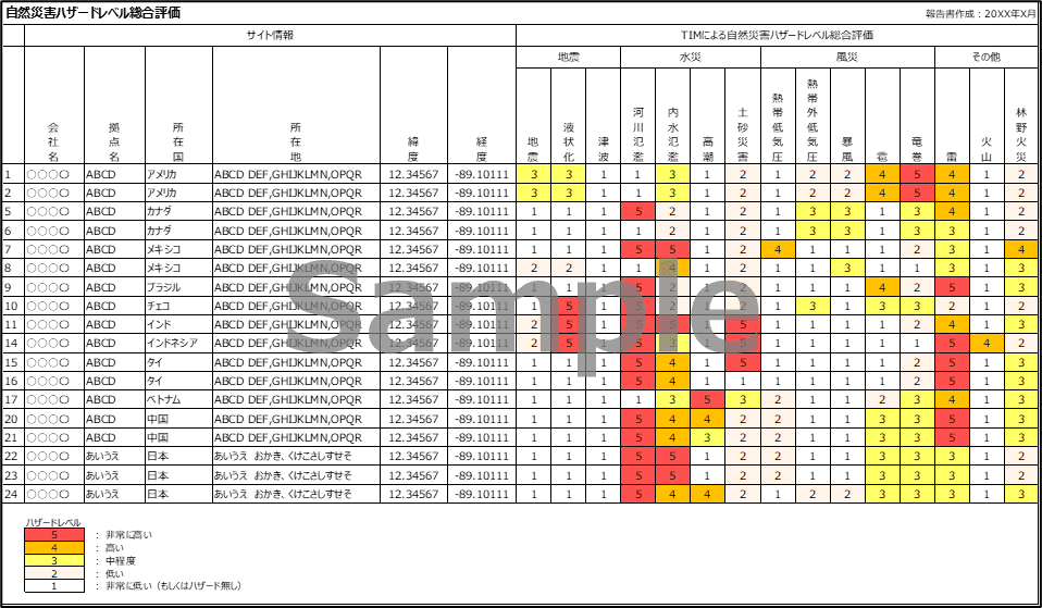
Visualizing the risk level across all business locations.
We provide a report evaluating the likelihood of 15 types of natural disasters, including earthquakes, liquefaction, tsunamis, floods, storm surges, landslides, windstorms, hailstorms, lightning strikes, volcanoes, and forest fires, for each target location. In addition to government and municipal hazard maps, we utilize reliable overseas information sources to organize and compare hazard levels for each location according to our own unique criteria. This evaluation is not intended to predict the extent of damage, but rather to objectively understand the degree to which each location is exposed to each type of natural disaster based on data. The evaluation results can be used as a valuable resource for disaster preparedness, business planning, and considering insurance conditions and coverage.
Furthermore, on-site risk assessments will be conducted as needed to evaluate whether measures commensurate with the hazard level at the site are in place, from the perspectives of the resilience of facilities against natural disasters, physical countermeasures, disaster prevention organizational structure, and business recovery capabilities, and to identify site-specific risks.